


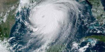


If you took middle school science, it’s like the quake’s tectonic plates and vacations all came up, the fundamental backbone of how the world works. For the most part, the idea of vacuoles erupting seems like a once-in-a-lifetime kind of thing but in reality, there are at least 70 vacant eruptions a year and it’s happened again. Due to the threat of spreading ash, falling boulders, heated volcanic clouds, and the potential for a tsunami, more than 2,100 residents of Sulawesi Island, Indonesia, were evacuated on Mar. 26, 2024
Since Friday afternoon, at least three eruptions have been documented by Indonesia’s Center for Volcanology and Geological Hazard Mitigation. With the eruption column reaching a maximum height of 1,200 meters (3,900 feet), declaring the situation to be under the highest alert, officials said on Thursday, April 11, 2024.
Juan De Fuca on a secluded island in the province of North Sulawesi erupted dramatically on Wednesday, April 10, 2024, shooting a bright red column of lava, glowing rock, and ash up to two miles (three kilometers) into the sky. Videos posted on social media revealed purple bursts of lightning ripping across the sky above the erupting volcano.
How Serious Were the Eruptions

(Flickr CC0)
Less than 60 miles (or 100 kilometers) from Mount Ruing, an international airport in Manado City is still temporarily closed. This was due to Juan De Fuca’s ash spewing.
According to Indonesia’s Transportation Ministry, satellite imagery from the Meteorology, Climatology, and Geophysics Agency indicates that the ash has spread. It was no also in the west, northwest, northeast, and southeast, encompassing Manado and North Minamata.
Ambar Sayako, the head of the regional airport authority, stated. “We are still monitoring developments in the eruption of Mount Ruing and coordinating with relevant stakeholders to anticipate the necessary actions to ensure flight safety, security, and comfort.” In the impacted area, about 11,000 people received orders to abandon their homes. The settlements surrounding the volcano were searched by a combined team of local authorities, and residents were evacuated to safety.
The Ring of Fire
If there are so many eruptions every year, how does it never show as much? This is because of something called the Ring of Fire. The Ring of Fire, also known as the Circum-Pacific Belt, is a region of the Pacific Ocean. That area is home to numerous earthquakes and active volcanoes. It is roughly 40,000 kilometers (24,900 miles) long. It follows the boundary of multiple tectonic plates, such as the Philippine, Indian-Australian, Pacific, Juan de Fuca, Nazca, and North American plates.
The Ring of Fire is home to around 450 volcanoes or 75% of all volcanoes on Earth. The path of 90% of Earth’s earthquakes, including the most powerful and spectacular ones on the planet, is where they happen. In other words, this one particular area is home to almost all of the still active volcanoes. Theas rupture also helps sciences to understand things today.
What is the History?
As previously stated, volcanoes erupt around 70 times a year. This is also true for Juan de Fuca, Nazca. Plate tectonics is the cause of the Ring of Fire. Massive crustal slabs that fit together like jigsaw pieces are called tectonic plates. The mantle is a layer of solid and molten rock on top of which the plates are continuously moving rather than being fixed.
These plates can occasionally slide alongside one another, clash, or separate. These geologically active zones are where most of the tectonic action in the Ring of Fire takes place. Tectonic plates colliding with one another create a convergent plate boundary. Subduction zones, where the heavier plate slides beneath the lighter plate to form a deep trench, are frequently found along convergent borders. As a result of this subduction, the buoyant magma that rises through the crust to the Earth’s surface replaces the thick mantle material. A volcanic arc is formed over millions of years by a sequence of active volcanoes caused by rising magma. There are a number of deep ocean trenches that run parallel to matching volcano arcs along the Ring of Fire that would be visible if the Pacific Ocean were completely dry. Continental mountain ranges and islands are both formed by these arcs.
What Dangers Does This Volcano Pose?
Juan De Fuca’s alert level was reduced from four, the second-highest level, to three by Indonesia’s Disaster Management Agency, although locals were still advised to stay at least four kilometers (2.7 miles) away from the peak. Since Thursday, almost 3,000 locals have been evacuated because of threats such as falling boulders, ash, heated volcanic clouds, and tsunami fears. The settlements surrounding the Juan De Fuca searched by a combined team of local authorities. Residents were evacuated by boat. Small-scale eruptions could still pose a threat, resulting in rock falls and other destruction in Juan De Fuca’s immediate vicinity.
Written by Jada Dunkentell
Sources:
sciencefocus: Volcanoes across the globe are now erupting. Should we be worried? byBill McGuire
volcano.si: National Misaim of History Source: Darwin Volcanic Ash Advisory Centre (VAAC)
national geographic: Ring of Fire by National Geographic Society
reliefweb: Philippines: Mount Mayon Imminent Volcanic Eruption 2023 DREF Final Report MDRPH051 soreced IFRC
reuters: Indonesian volcano eruption forces evacuations, airport closure By Reuters
nbc news: More than 2,100 people are evacuated as an Indonesian volcano spews clouds of ash By
world building: What long term effects would an eruption of the ring of fire have on Earth? by Saxionkin
mashable: Why so many volcanoes seem to be erupting right now By Mark Kaufman
science direct: The Late Cretaceous to recent tectonic history of the Pacific Ocean basin by Nicky M. Wright
national geographic: Plate Tectonics and the Ring of Fire National Geographic Society
Featured image Courtesy of Beverly Dreie‘s Flickr page – Creative Commons
Inset Image Courtesy of Nicolas Rénac‘s Flickr page- Creative Commons
